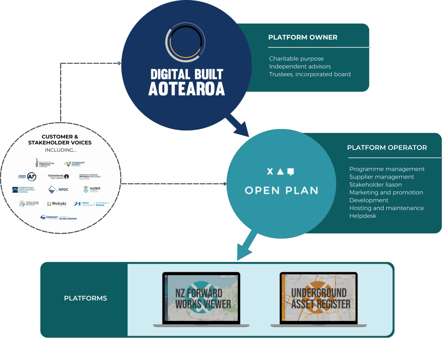
The National Forward Works Viewer is owned by Digital Built Aotearoa, a purpose-built foundation whose mission is to encourage collaboration and knowledge-sharing from lessons learned in recovery infrastructure projects to enable and improve infrastructure resilience throughout Aotearoa.
Open Plan are the programme lead for the NFWV. With a historical association going back to the inception of the tool, they engage with current and existing stakeholders, onboard organisations, and liaise with the technical services team to ensure that the NFWV is fully functional.
The NFWV is also supported by Jacobs, who build the processes to bulk upload the data.
Our other tools
The Underground Asset Register (UAR) is Aotearoa’s first online map of federated underground assets in one central location. Historically, underground asset information has been held by asset owners in various formats and locations. The UAR seeks to bring this information together into a simple and easy to understand format in one central location.
We are working with Wellington City Council and asset owners in the region to publish assets onto the map. Utility data is displayed on the map with interactive tools so users can understand what assets exist in their area of interest, who the asset owners are, and how to contact them. The UAR also provides a convenient mechanism for providing feedback when a user find something in the wrong place, or something that isn’t recognised. This feedback is provided to the utilities and to WCC to support updating the data sets that feed into the map.
Whilst the Underground Asset Register is still in beta phase and being developed, the eventual goal is to:
– View asset location and information from different organisations on one map
– View the data at any time, on any device
– Improve health and safety outcomes
– Mitigate programme risk
– Improve asset lifecycles
– Enable feedback on asset data quality
– Enable feedback on asset information
– Reduce community disruption
– Reduce project costs
– Reduce the chance of asset strike
– View assets in the context of other supporting geospatial information
If the pilot proves successful, the tool will be rolled out across the rest of Aotearoa.
We’re not recruiting right now, but if you’d like to build the smarts that help New Zealand deliver better infrastructure, feel free to flick your CV to [email protected], or check the Open Plan website for vacancies at the link below.